Chamoli/Joshimath
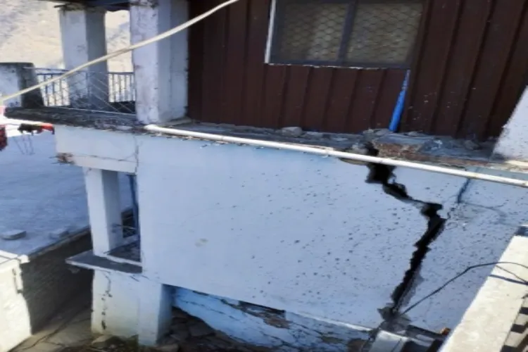
The Uttarakhand government on Sunday declared some areas of Joshimath as a disaster-affected area, based on the recommendations of the experts who had been surveying the houses in the holy city to identify the causes of the landslides.
The decision to declare the area of about one and a half kilometre, as 'unsafe for living' was taken late on Sunday evening.
Geotechnical and geophysical study of the city will be conducted for a long term solution. Guidelines will be issued for constructing buildings in areas where no cracks have appeared in the houses. Along with this, a hydrological study will be conducted.
Disaster Management Secretary, Dr Ranjit Sinha said that Pipalkoti, Gauchar, Koti Colony, among other places have been selected for the rehabilitation of the affected.
In view of the construction of pre-fabricated houses, Sinha has sought a proposal from the Central Building Research Institute (CBRI), Roorkee.The affected colonies have been evacuated. The Army had instructed the jawans, living in rented accommodations to vacate the premises, and they have been shifted to safer places.
Both the Indian army and the Indo-Tibetan Border Police (ITBP) have been stationed in the city.
Joshimath is the last town on the Indo-Tibetan border, from where the Niti and Mana valleys join the border., Imf
Sinha apprised that some parts of the premises of Army, ITBP, NTPC and Jaypee Company were also in the landslide zones.
ITBP has been vacating the colony, while Jaypee has vacated some of its residences and NTPC is preparing to do the same.
The landslides have now been moving towards the Army and ITBP camps. Along with the collapse of the road to the camp, the border connecting Malari Highway has also caved in, which may create problems for the army in view of transportation and provision.

